


San Juanico – North
The Central Sea Classic
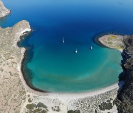
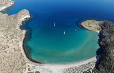
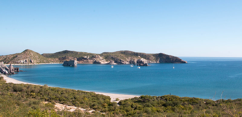
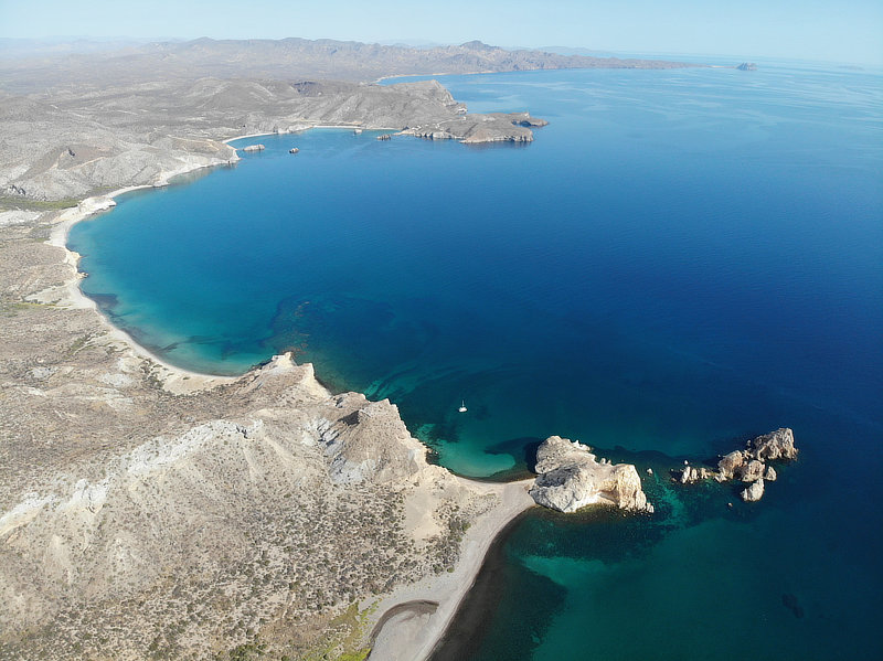
San Juanico has been a favorite of cruisers in this area for many years, so much so that a cruisers’ shrine tree on one of the northern shores is decorated with mementos and found art from dozens of boats. It’s a visually stunning area, with a few pocket coves to choose from among steep-walled islets, headlands, and sweeping rock formations. While there are a couple of fancy houses here and a beach campground, it’s almost always very quiet and peaceful.
Approach
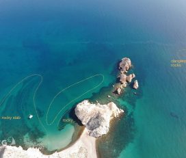
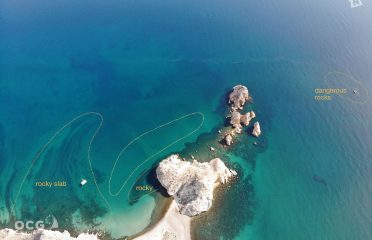
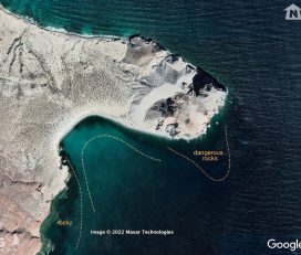
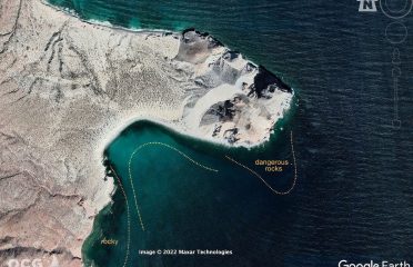
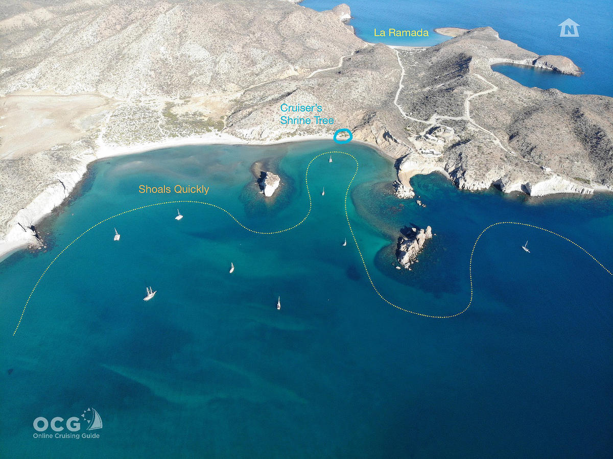
Open from north. When approaching from the south, give room on the large rock 1/4 mile off the southern point (Mercenarios) marking entry into the bay. There is also a pinnacle rock marked on our chart nearly two miles out here, but we have been unable to spot it. Once you angle into the north end of the bay, you only need to be on your toes as you approach or pass any obvious chunk of rock. The rocky spires and reefs on the north end should be easily visible, and generally the water is deep right up to them. But note that the bay in front of the campground shoals very quickly.
Anchoring/Mooring
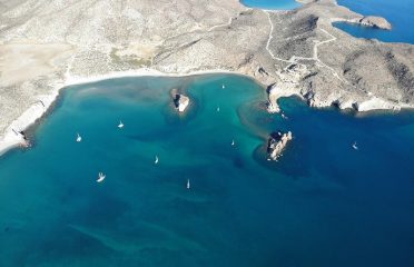
This will depend a bit on your draft, but most boats tend to prefer what most think of as the middle anchoring area, between the prominent Islet furthest west and the rock peninsula that juts south from below the big house. Cats and tris will often work their way up into the inner sanctum here, but most are quite content between the rock formations and further out. Obviously make sure to give yourself plenty of room to swing, as currents and breezes here come from all quarters. Good holding sand in 15-30 feet in the middle area, 5-10 feet if you venture closer to shore.
Click on the gallery above the title for more images
Ashore
San Juanico is braided with hiking trails, and loaded with sweet pocket beaches separated by imposing bluffs and headlands. This is a spectacular place to explore on foot. Do note the private land in the center and northern areas of the bay, however. A nice walk can be had along the northern road to La Ramada, and also west from the campground (low flats) to a well-kept rancho where cheese, eggs and vegetables can be found in-season.
Don’t Miss
A visit to the Cruisers’ Shrine Tree is a must, of course, and you should feel free to add some art or memento of your own from your boat, dated with the year you were there. It’s always fun and interesting to look through the constantly changing collection.
 Is this your place?
Claim Now!
Claim Now!
Is this your place?
Claim Now!
Claim Now!
![]() See something amiss?
Report Now!
See something amiss?
Report Now!

-
$99.00
/ Per Listing
-
Duration : 365 days
Lorem ipsum dolor sit amet, lorem sit.
- Map Display
- Contact Display
- Image Gallery
- Video
- Tagline Text
- Location
- Website
- Social Links
- FAQ
- Price Range
- Tags/Keywords
- Business Hours
- Menu
- Announcement
- Deals-Offers-Discounts
- Hide competitors Ads
- Events
- Lead Form
Claim request is processed after verification..
Posts About This Place
-

Isolation in The Sea: Photo-vid Mash-up
2020 Summer of COVID-19 Holy cow!! As I lamented in […]
-

Time to Head South (Again) to La Paz
November 25 – December 14, 2018 Still getting caught up […]
-

San Carlos to Puerto Escondido and Environs
October 27 – November 16, 2018 Once we came to […]
-

Back Down The Baja: Destination Puerto Esco
We knew our time in Bahía de los Ángeles had […]
Other Options Nearby